Lundin Group
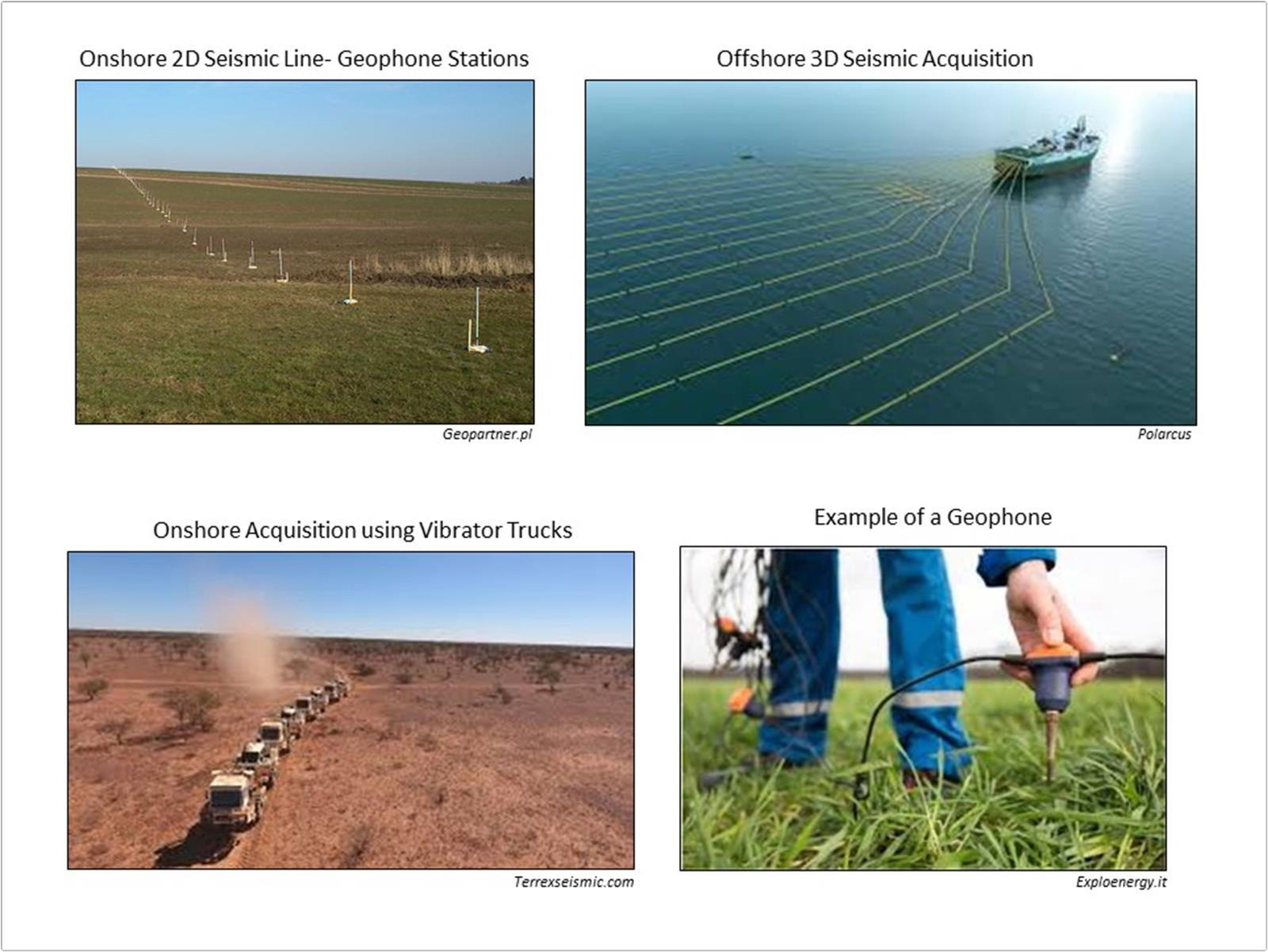
Seismic exploration is the search for commercially economic subsurface deposits of crude oil, natural gas and minerals by the recording, processing, and interpretation of artificially induced shock waves in the earth. Artificial seismic energy is generated on land by vibratory mechanisms mounted on specialized trucks. Seismic waves reflect and refract off subsurface rock formations and travel back to acoustic receivers called geophones. The travel times (measured in milliseconds) of the returned seismic energy, integrated with existing borehole well information, aid geoscientists in estimating the structure (folding and faulting) and stratigraphy (rock type, depositional environment, and fluid content) of subsurface formations, and determine the location of prospective drilling targets.
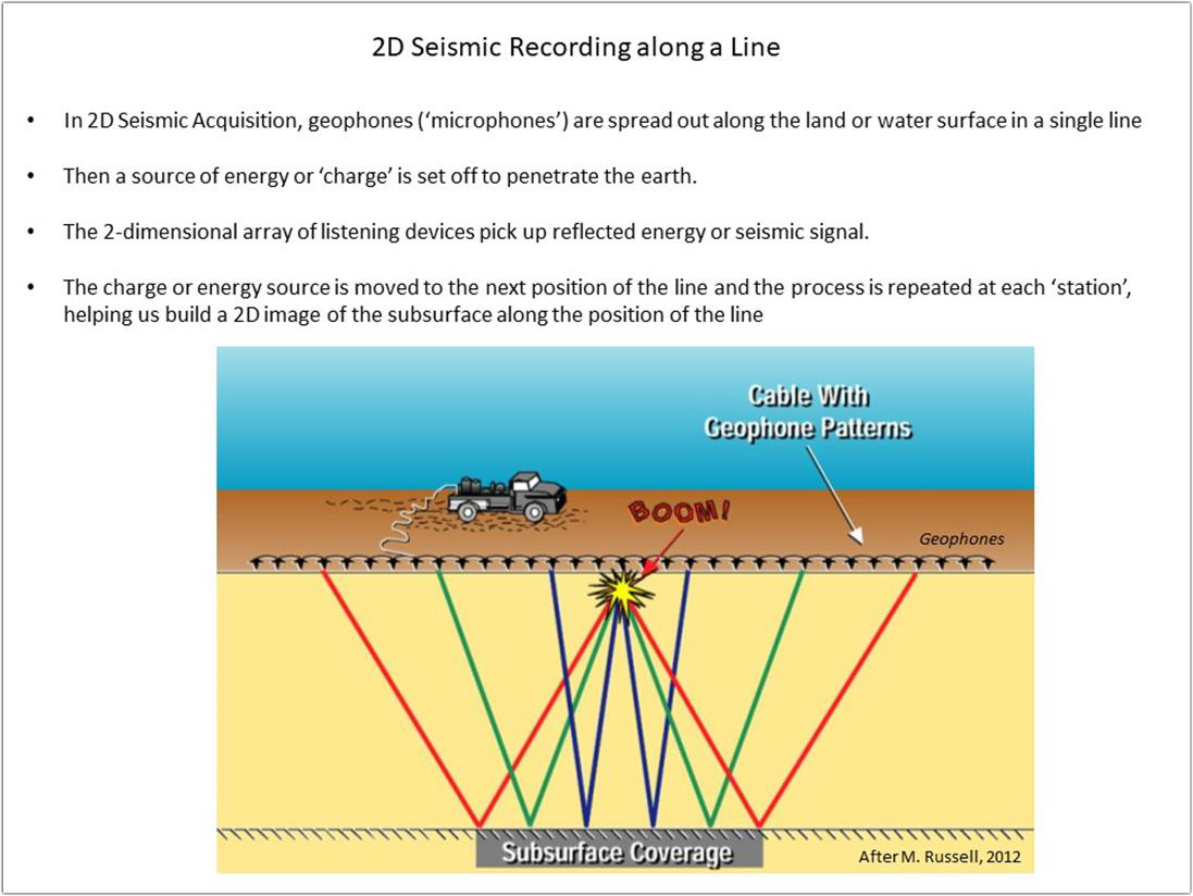
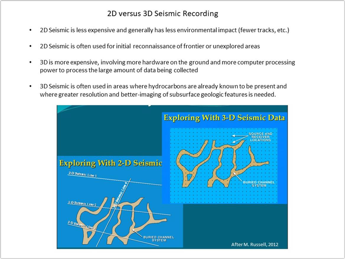
In two-dimensional (2D) reflection seismic surveying both the sound source and the sound detectors (numbering up to a hundred or more per shot) are moved along a straight line. The same line contains recording cables and geophones as well as source points. The resultant product can be thought of as a vertical sonic cross-section of the subsurface beneath the survey line. It is constructed by summing many compressional (pressure) wave reflections from the various sound source and sound detector locations at the halfway sound path points beneath each location (common depth point stacking).
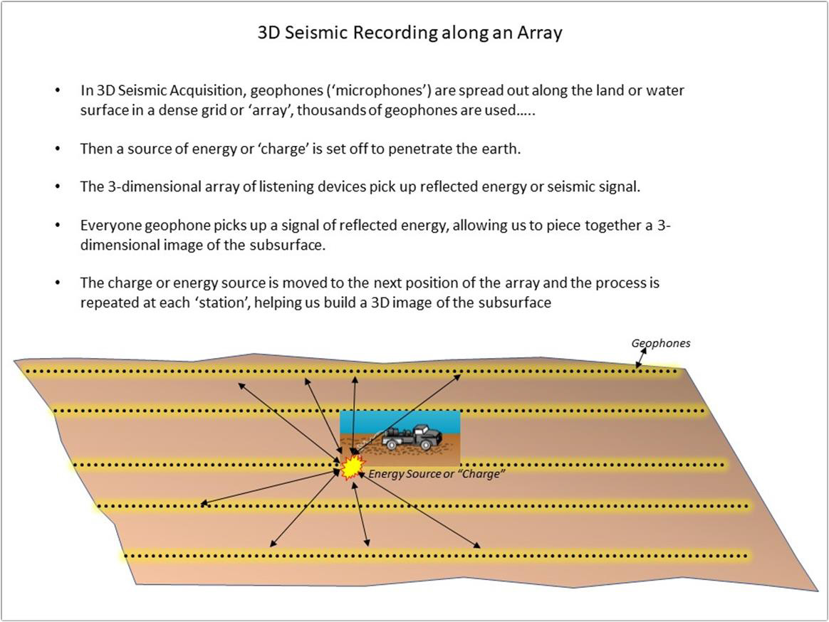
In three-dimensional (3D) reflection seismic surveying the sound detectors (numbering up to a thousand or more) are spread out over an area and the sound source is moved from location to location through the area. 3D seismic programs are generally a uniform and evenly spaced grid of lines. Receiver lines containing the recording devices (geophones) usually, but not always, run in a direction perpendicular or diagonal to the source lines. The resultant product can be thought of as a cube of common depth point stacked reflections. Advantages over 2D include the additional dimension, the fact that many more reflections are available for stacking at each point, which provides greatly improved resolution of subsurface features, and elimination of the "ghost" or "side swipe" reflections from nearby offline features that 2D surveys are prone to (except, of course, along the outer faces of the cube).
Return Home